Embracing Technology in Commercial Roofing
Discover how advanced tools and AI are transforming efficiency and insight in the roofing industry.
Read More →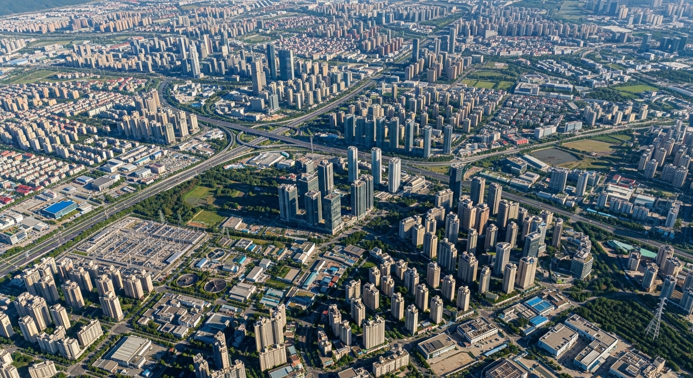
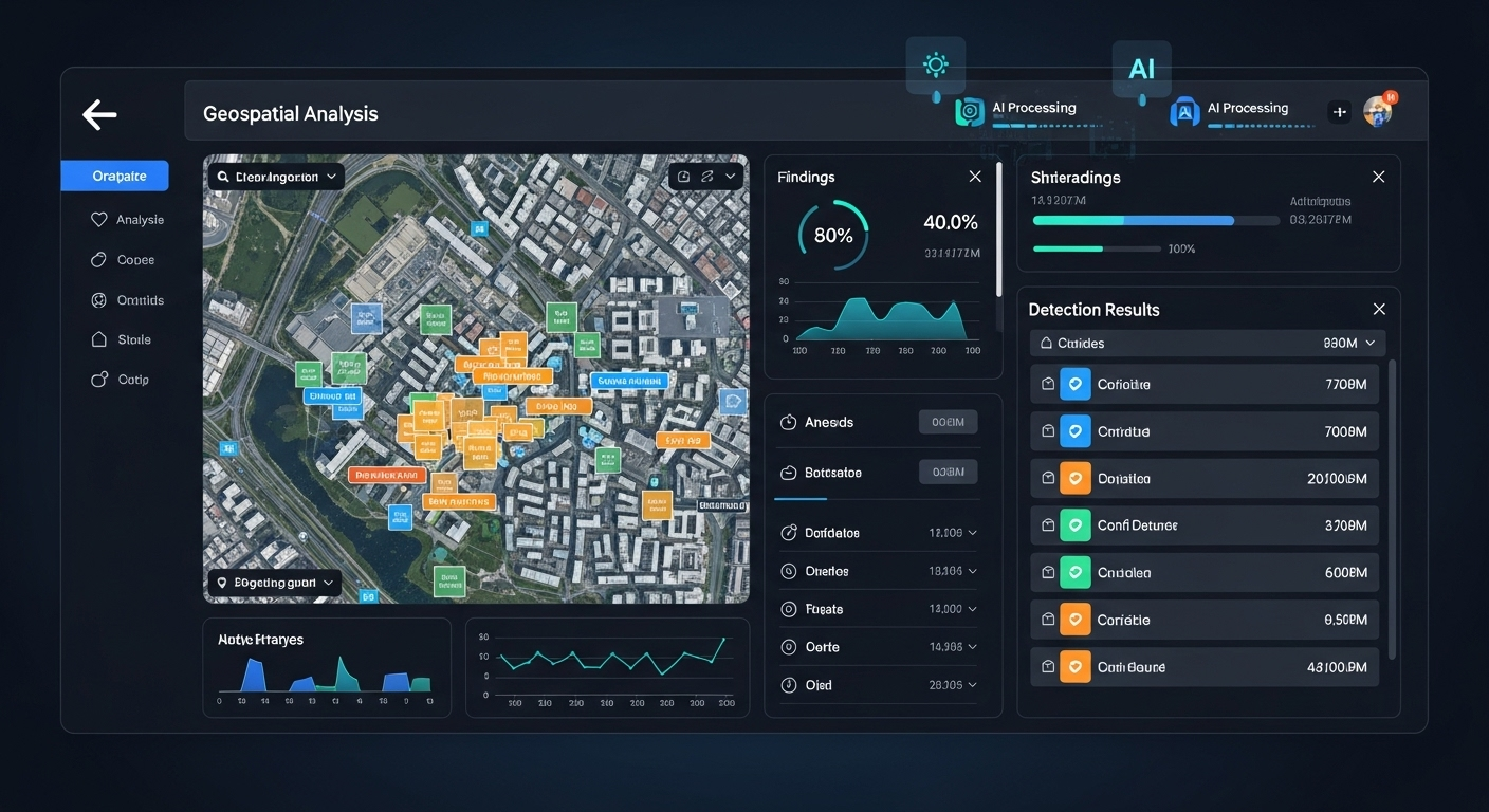
Transform satellite, aerial, and drone imagery into actionable insights.
Everything you need for comprehensive geospatial analysis
Analyze thousands of images in seconds. Our AI models are optimized for speed without compromising accuracy.
Our AI models are optimized for speed without compromising accuracy.
Our AI models utilize real-time satellite imagery, and drone technology to provide the most accurate aerial measurements.
4k photos/video footage, and online software tools customized for fastest and highest quality photo uploading & reviewing capabilities within a cloud-based application
Trusted across multiple sectors for mission-critical analysis
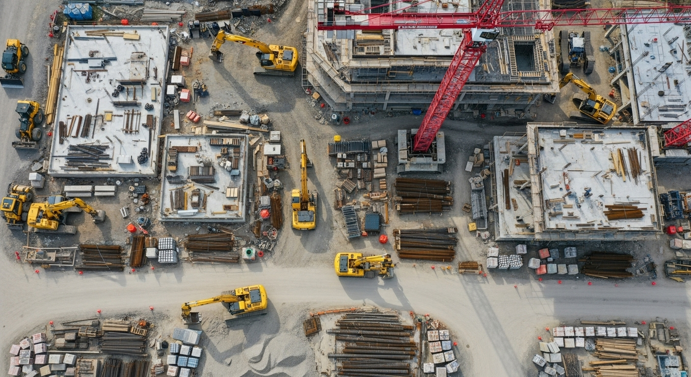
Track project progress, measure earthwork volumes, and ensure safety compliance.
Monitor crop health, optimize irrigation, and maximize yields with precision agriculture.
Property assessment, development planning, and market analysis at scale.
Track deforestation, monitor wildlife, and assess environmental impact.
City development, infrastructure planning, and land use optimization.
Infrastructure inspection, asset management, and predictive maintenance.
Volume calculations, site monitoring, and operational optimization.
Dronnav adapts to your unique needs. Train custom AI models for any use case.
Choose the plan that fits your needs

Insights, updates, and industry news